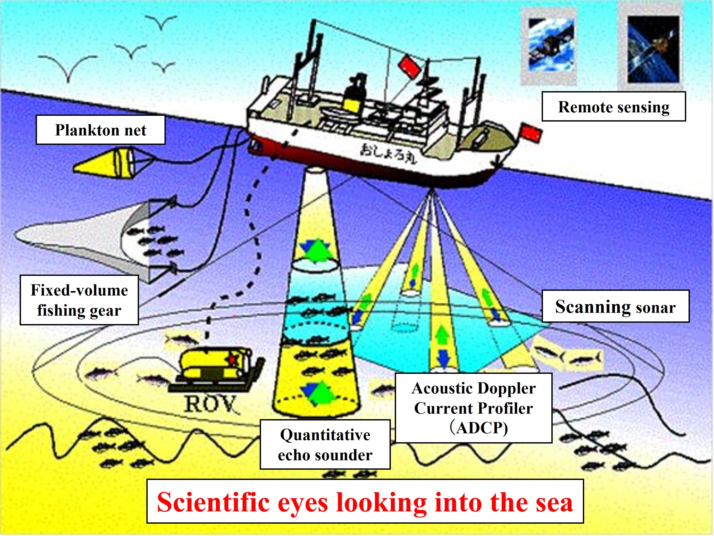
Electromagnetic waves are mainly used for GPS to determine the position of ships at sea and for satellite remote sensing to measure the surface environment. On the other hand, sound waves are mainly used to measure underwater information such as water depth and the presence of fish. As shown in the figure below, this course provides an overview and principles of positioning and satellite remote sensing using electromagnetic waves, underwater bathymetry usi
ng sound waves, echo sounder, ADCP for measuring ocean currents, and methods for measuring basic oceanographic parameters (water temperature, salinity, depth, etc.).


