Satellite oceanography (undergraduate specialty) class introduction course
Garis besar topik
-
Faculty: Yasuto Abe, Takashi Hirasawa
What do you associate with the word "satellite"?
Many people may find GPS, television, and telecommunications to be a part of our daily lives.
In this course, students learn about satellites as a tool for obtaining information on the oceans, which cover 70% of the Earth's surface.
Many people are now aware of global-scale ocean-related problems such as global warming, climate change, depletion of marine resources, and plastics in the oceans. To solve these problems, it is important to accurately understand the state of the ocean.
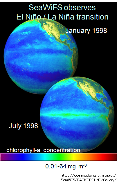
Satellites remotely receive electromagnetic waves emitted, reflected, and scattered from the ocean surface and convert this primary data into various ocean variables based on algorithms. As a result, not only physical data such as sea surface temperature, salinity, altitude, sea surface winds, and ocean currents but also biological data such as chlorophyll, the pigment of phytoplankton, can be obtained.
In this lecture, you will learn what kind of satellites measure what and how, and their advantages and disadvantages.


