【Commentary: From the Japan Meteorological Agency website】
The tide table posted on this website is a summary of tide level forecast values (astronomical tide levels) calculated based on analysis of past tide level data. Please note that this predicted value (astronomical tide level) differs from the actually observed value (measured tide level) due to various factors such as weather. For the values observed in the past, please refer to the tide observation data. For the latest tide levels (yesterday, today, tomorrow's actual tide levels and astronomical tide levels), please see tide level observation information.
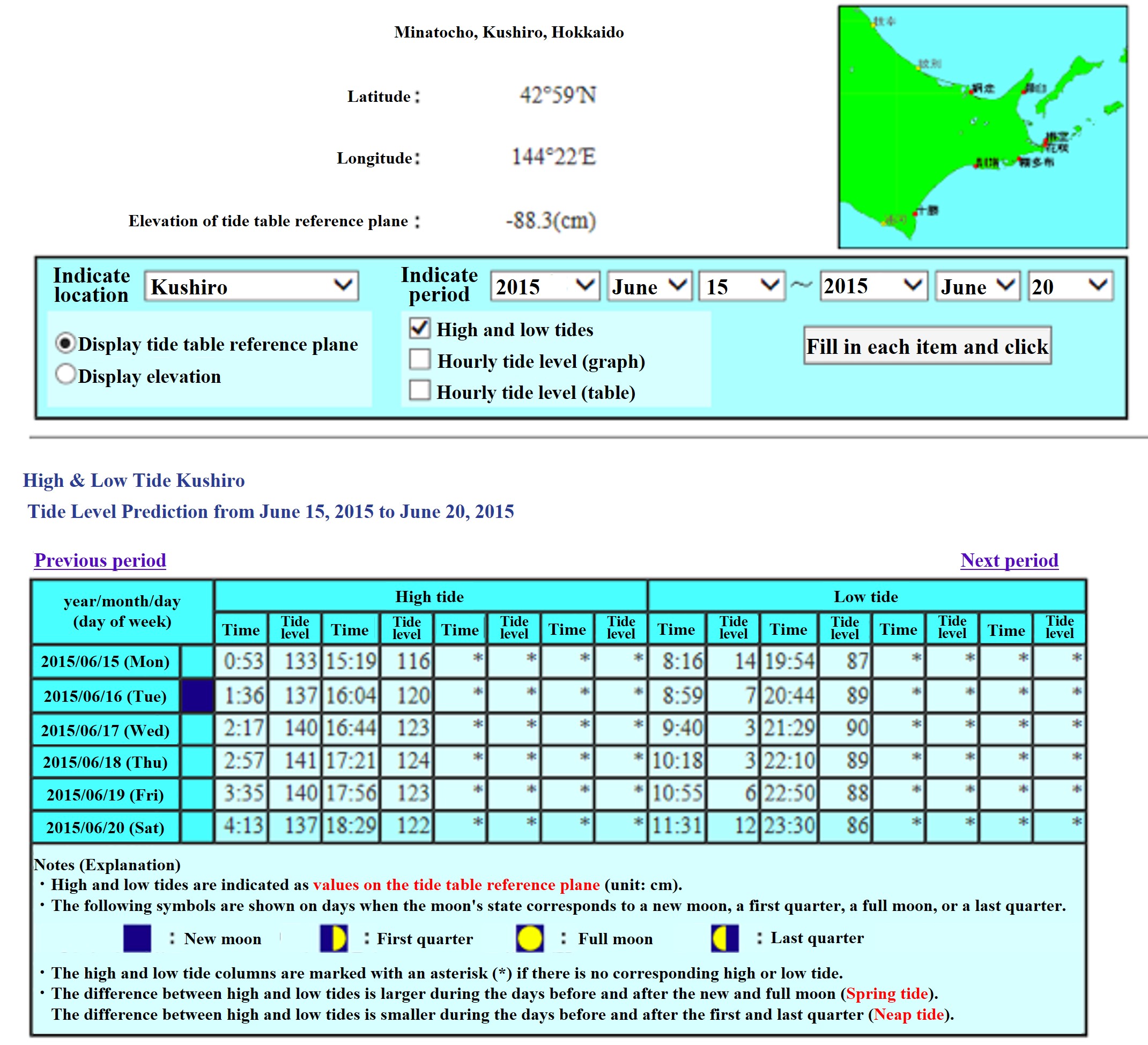
The tide levels listed here are indicated by the tide table reference surface display (height from the tide table reference surface) and TP display (elevation) in cm. The tide table reference surface is different for each point. The elevation value of the tide table reference plane is posted at the top of the tide table list and the tide table page for each point.TP stands for Tokyo Bay Mean Sea Level, which is the standard for elevation. In addition, at some points such as remote islands, instead of the mean sea level of Tokyo Bay, the height standards of the Geospatial Information Authority of Japan and the MSL (mean tide level) are used. If you want to change the tide level value from the tide table reference plane display to the TP display, follow the instructions on the screen to switch the display. Please note that the value of "elevation of the tide table reference plane" is updated every year according to the reflection of survey results and changes in MSL (mean tide level). The display period is up to 5 weeks.
All times are posted in Japan Standard Time (JST).