
Why do ocean observations at Funka Bay?
섹션 개요
-
-
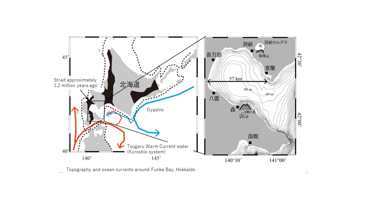
Funka Bay is an inner bay located in the southwestern part of Hokkaido.
The areas shaded in black in the figure on the left below were once oceans hundreds of thousands of years ago. Funka Bay is thought to have been a strait connecting the Pacific Ocean and the Sea of Japan long ago.
There are many active volcanoes around Funka Bay, hence its name (“Funka” means “eruption” in Japanese[A1] ).
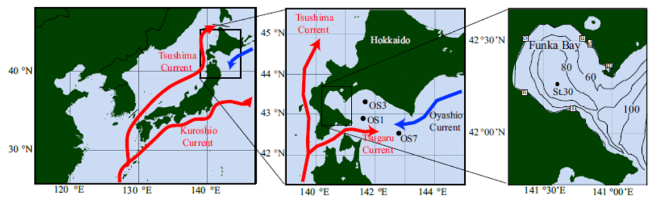
Please look at the ocean current map (left figure below). You can see the cold Oyashio current and the warm Kuroshio current (→Tsugaru Warm Current) flowing nearby.
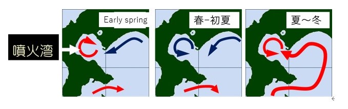
In early spring, the Oyashio water flows into Funka Bay. In the late summer, the Tsugaru Warm Current flows into Funka Bay.
-
The water in Funka Bay switches out in early spring and late summer. Hence, the water remains in the bay from spring to summer and autumn to winter.
During that period, it is possible to track water changes over time in the open-ocean water (Oyashio water, Kuroshio water).
(It is almost impossible to observe the same water in areas with an ocean current even if observations are recorded in the same location every month)
We are continuing ocean observations of Funka Bay every month with the idea that we will be able to discover various things.
We have clarified the factors that change the concentration of plant-derived isoprene and the resultant knowledge on the generation of organic iodine gas.
-
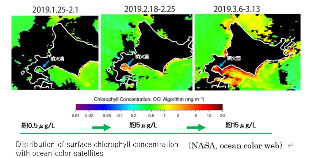
There is a diatom bloom every year for about three weeks starting in early March. Approximately half of the annual primary production in Funka Bay is supported by this diatom bloom in the spring.
The following is a distribution of chlorophyll concentration on the sea surface, which was measured using satellites.
-